With more snow on the way, Indy officials suggest working from home Friday. Here's the forecast.
 Katie Wiseman
A hazardous winter (7 day) outlook has been shared by National Weather Service for Central Indiana, Southwest Indiana and Northern Indiana. Day one starts Thursday night and day seven is Wednesday.
Periods of light snow are possible Friday through Saturday with minimal snow accumulations expected. Bitterly cold temperatures will return this weekend and will raise concerns for ice jams along area rivers and streams this weekend.
A Winter Weather Advisory has been issued for 9 p.m. on Thursday through 10 a.m. on Friday and this includes the following cities: Clinton, Fairview Park, Rockville, Montezuma, Rosedale, Greencastle, Plainfield, Brownsburg, Danville, Indianapolis, Greenfield, New Castle, Martinsville, Mooresville, Greenwood, Franklin, Shelbyville, Rushville and Greensburg.
A Wind Chill Advisory has also been issued from 7 p.m. Friday through 10 a.m. Saturday and includes the same cities listed above.
With the low temperatures we'll be seeing, Greg Melo from NWS Indianapolis says to keep in mind that snow could accumulate on the roads very easily.
"The temperatures are gonna be fairly cold so it's gonna accumulate very easily on the roads and the roads," Melo said. "So just be aware of any untreated roads that has snow cover and slick spots."
If you're sick of the cold, there may be some hope of it warming up a bit next week.
"Next week we should start to warm up and we'll have some better chances for rain, we'll probably have multiple rounds of rainfall next week, but we will warm up," Melo said. "So anybody that's tired of the cold should be very happy with the temperatures next week."
We're sick of winter.When's spring already?
Indianapolis Department of Public Works asks all who can work from home on Friday.
In a statement released on Thursday afternoon, Indy DPW recommended anyone who has the ability to work from home on Friday should.
"Officials within DPW are encouraging those who have the availability to work remotely on Friday to do so to help alleviate pressure on the Friday morning commute, which could see significant impact depending on the snowfall totals," Indy DPW said.
If you still have to venture out tomorrow, Indy DPW recommends winter traveling best practices:
- Staying informed: Before leaving home, find out about the road conditions. Drivers need to know the weather and their limits. Follow the National Weather Service (NWS) and local media to help you stay on top of the latest conditions and forecasts.
- Clear your vehicles: Remove any snow on your vehicle’s windows, lights, brake lights and turn signals. Blowing snow from vehicles can be dangerous when on the roadway as well as hinder your visibility.
- Time and space: Leave plenty of time to reach your destination safely. Motorists can forget to take it slow when conditions appear to be fine, especially in the overnight hours when black ice can be an issue for bridges and elevated roadways. Remember to drive well below the posted speed limit and leave plenty of room between cars.
- Be prepared: Keep a basic winter survival kit in your vehicle, including a flashlight, batteries, blanket, snacks, water, gloves, boots, and a first-aid kit. Load your car with winter travel gear, including tire chains, ice scraper/snowbrush, jumper cables, and road flares.
Indianapolis residents can follow the Indy DPW on X, formerly known as Twitter, for updates about snow removal and road conditions.
Indy DPW also manages Indy Snow Force, their winter weather operations team, with an online map showing what roads have been plowed already in the city.
The Indy Snow Force road map can be found online at maps.indy.gov/IndySnowForceViewer. You can also follow them on X, @IndySnowForce.
Are Indianapolis area schools closed Friday?
As of 5 p.m. Thursday, most schools had not yet made a decision about Friday. Read more about how school districts make the call.
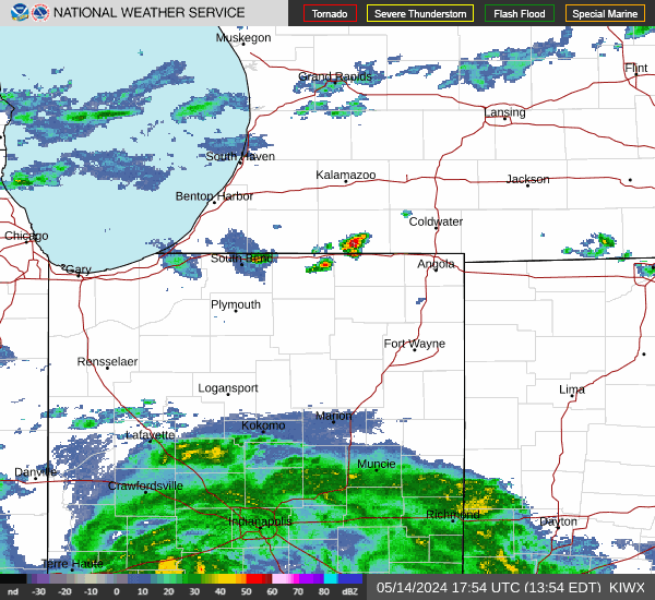
Indianapolis weather radar

Thursday Night: We should see Snow Thursday night, mainly after 10 p.m. Temperature low around 17 degrees. Light and variable wind becoming northwest 5 to 9 mph after midnight. Chance of precipitation is 100%. New snow accumulation of less than one inch possible.
On Friday there is "potential for hazardous conditions as you're driving, especially especially along the I 70 Corridor north," Greg Melo at NWS Indianapolis said.
Indianapolis Department of Public Works (Indy DPW) has asked that anyone who can to work from home tomorrow due to the overnight snowfall and hazardous road conditions.
Friday: A 30% chance of snow showers. Mostly cloudy, with a temperature falling to around 14 by 5 p.m. Wind chill values as low as -1. West northwest wind 15 to 18 mph, with gusts as high as 26 mph.
Friday Night: A 30% chance of snow showers before 1 a.m. Mostly cloudy, with a low around 5 degrees. Wind chill values as low as -9. West northwest wind around 14 mph, with gusts as high as 20 mph.
Saturday: Partly sunny, with a high near 16 degrees. West northwest wind around 10 mph.
Saturday Night Mostly clear, with a low around 3 degrees. West northwest wind 5 to 10 mph.
Sunday: Sunny, with a high near 24 degrees. West southwest wind 5 to 10 mph becoming south in the afternoon.
Sunday Night: Mostly cloudy, with a low around 18 degrees. South southeast wind 10 to 13 mph, with gusts as high as 20 mph.
Evansville weather radar

Thursday Night: A 30% chance of snow after 1 a.m. Mostly cloudy, with a low around 17. South wind 5 to 15 mph becoming northwest after midnight. Winds could gust as high as 22 mph.
Friday: A 30% chance of snow before 7 a.m. Mostly cloudy, with a temperature falling to around 17 by 9 a.m. Northwest wind 13 to 18 mph, with gusts as high as 26 mph.
Friday Night: Mostly cloudy, with a low around 6 degrees. Wind chill values as low as -8. Northwest wind 10 to 13 mph, with gusts as high as 20 mph.
Saturday: Mostly sunny, with a high near 19 degrees. Northwest wind around 10 mph.
Saturday Night: Mostly clear, with a low around 8 degrees. North wind 3 to 8 mph.
Sunday: Mostly sunny, with a high near 29 degrees. Light and variable wind becoming southeast 5 to 10 mph in the morning.
Sunday Night: Partly cloudy, with a low around 22 degrees. Southeast wind around 11 mph.
Fort Wayne weather radar
Thursday Night: Snow, mainly after 8 p.m. Low around 16 degrees. North wind around 5 mph. Chance of precipitation is 100%. New snow accumulation of 1 to 3 inches possible.
Friday: Snow likely, mainly after 1 p.m. Cloudy, with a high near 21. North wind 5 to 10 mph. Chance of precipitation is 70%. New snow accumulation of 1 to 2 inches possible.
Friday Night: Snow likely. Mostly cloudy, with a low around 8 degrees. Northwest wind around 5 mph becoming calm after midnight. Chance of precipitation is 70%. New snow accumulation of 2 to 4 inches possible.
Saturday: A 30% chance of snow, mainly before 1 p.m. Mostly cloudy and cold, with a high near 20 degrees. Northwest wind 10 to 15 mph, with gusts as high as 20 mph.
Saturday Night: A 20% chance of snow before 10 p.m. Mostly cloudy, with a low around 0 degrees.
Sunday: Mostly sunny and cold, with a high near 19 degrees.
Sunday Night: Mostly cloudy, with a low around 11 degrees.

South Bend weather radar
A winter storm warning will be in effect from 10 p.m. Thursday until 7 a.m. Saturday in South Bend.
Thursday Night: Expect some snow, mainly after 8 p.m. Low around 16 degrees. North wind around 5 mph. Chance of precipitation is 100%. New snow accumulation of 1 to 3 inches possible.
Friday: Snow likely, mainly after 1 p.m. Cloudy, with a high near 21 degrees. North wind 5 to 10 mph. Chance of precipitation is 70%. New snow accumulation of 1 to 2 inches possible.
Friday Night: Snow likely. Mostly cloudy, with a low around 8 degrees. Northwest wind around 5 mph becoming calm after midnight. Chance of precipitation is 70%. New snow accumulation of 2 to 4 inches possible.
Saturday: A 30% chance of snow, mainly before 1 p.m. Mostly cloudy and cold, with a high near 20 degrees. Northwest wind 10 to 15 mph, with gusts as high as 20 mph.
Saturday Night: A 20% chance of snow before 10 p.m. Mostly cloudy, with a low around 0 degrees.
Sunday: Mostly sunny and cold, with a high near 19 degrees.
Sunday Night: Mostly cloudy, with a low around 11 degrees.
Weather safety reminders: Get your winter preparedness kits ready
While the severity of the storm is unknown, it is important to make sure you are prepared. Meteorologist Greg Melo recommends having a preparedness kit in your car and home and layer up if you need to go outside.
"Make sure you have any kind of preparedness kits that you need in your house to stay warm and if you have to go outside to make sure you're bundled up," Melo said.
NWS has a Winter Preparedness Checklist on its website with recommendations for what to include in your kits should you need them.
How to stay warm when the power is out
If you happen to lose power during the cold weather, NWS shared some tips on how to stay warm without electricity.
- Wear layers of loose-fitting, lightweight, warm clothing as well as hats, mittens, and blankets.
- Close blinds or curtains to keep in some heat.
- Close off rooms to avoid wasting heat.
- Place towels or rags in cracks under doors.
- Practice portable generator safety: use outdoors, at least 20 feet away from doors/windows/garages to avoid carbon monoxide poisoning. Follow instructions on proper use.
- Once your family is safe, check on your neighbors and the vulnerable to make sure they are okay.
Bundle up if you have to go out. Frostbite and hypothermia possible.
In a Tweet shared Saturday afternoon, NWS warns about the risks of frostbite and hypothermia and reminds residents to make sure all skin is covered when heading outside this weekend, with as many layers as possible.
What to know about frostbite
"Frostbite can happen in minutes, especially on the extremities such as fingers, toes, nose and ears, but can affect any area of exposed skin," the NWS website said.
Redness or pain in any skin area may be the first sign of frostbite, according to the CDC.
Other signs include:
- a white or grayish-yellow skin area
- skin that feels unusually firm or waxy
- numbness
If you suspect frostbite, immediately move inside to a heated location and begin warming the affected areas using warm water or body heat, but do not use hot water or radiant heat like a fireplace. The affected areas can be easily burned.
Seek medical attention for severe frostbite.
What to know about hypothermia
"When your body temperature sinks below 95°F, you have hypothermia, a serious health hazard that occurs when body temperature is lowered too much," NWS said.
If you are trying to help someone who may have hypothermia, first call an ambulance as they need immediate medical attention.
If you can move them to a warmer location, do so. Then lie close to the person and cover both of you with thick blankets. The hotter you get, the more warmth you can give the other person.
It is important to begin warming the center of the body first. Don't rub the person or handle them roughly. If the person is unconscious, administer CPR.
Tips to preventing hypothermia:
- Dress in layers.
- Wrap up well when going outside in the cold.
- Avoid breezes and drafts indoors.
- Eat nutritious food and wear warm clothes to ward off winter chill.
- Wear a warm hat in the winter.
- Eat hot foods and drink warm drinks several times during the day.
- If you live alone, ask a family member or neighbor to check on you daily or have a camera installed that a family member can view on their computer.
- Ask your doctor if any medicine you're taking increases your risk of hypothermia. Drugs that may cause a problem include barbiturates, benzodiazepines, chlorpromazine, reserpine, and tricyclic antidepressants.
"If your temperature is 95°F or less, you feel cold and sluggish, or you are having trouble thinking clearly, see a doctor immediately or go to the nearest emergency room," NWS said. "It's better to be overly cautious than to die of a disorder that doesn't have to be deadly."
You can check their "During Extremely Cold Weather" page for more information.
Icy roads:Here's how to drive with common sense
Katie Wiseman is a trending and breaking news intern at IndyStar. Contact her at klwiseman@gannett.com. Follow her on Twitter @itskatiewiseman.